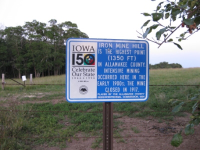
Allamakee County HP
IA
Elevation: 1,350'
Rise: 155'
County: Allamakee
Quad: Waukon
Line Parent: Pilot Knob
Proximate Parent: Wadels Hill
Allamakee County Highpoint
Isolation: 57.20 miles
YDS Class: 2 Suggest Revision
Add ascent
Weather Forecast
Snow Depth
Images:
 jmbrooks8 04-19-2012 | 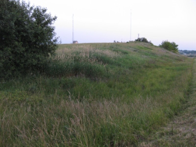 jmbrooks8 04-19-2012 |
Submit another Image
Trip Reports:
Submit a Trip Report
Links: peakbagger.com
Ascents:
11 members have reported ascents...
log in to view ascents