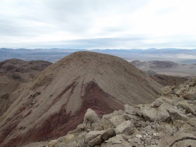
Saddle Peak Hills
CA 
BGN PageAlternate Names
: Ibex Benchmark DatasheetElevation
: 2,560' (LiDAR) map: 2,555'CA Rank
: 8309CA Prominence Rank
: 810County
: San BernardinoQuad
: Saddle Peak HillsCoords
: 35.74185°N, 116.33938°W Notice
: 35.74185°N, 116.33938°W NoticeRise
: 1,098' (LiDAR) map: 1,096'Saddle
: 1,462' (LiDAR) map: 1,459'LiDAR Notes
Line Parent
: McLain BenchmarkParent Lineage
Proximate Parent
: 2608Isolation
: 4.20 milesDeath Valley Wilderness
Death Valley National Park
Submit YDS Class Rating
Weather Link
Snow Depth
CalTopo
Custom List Entries
Notes: Determined by multiple parties to be higher than summit to NE with 780m+ contour - this extra contour also erroneous, verified by LiDAR.
Trip Reports:Submit a Trip Report
Report 1
Report 2
Report 3
Links: peakbagger.com
Ascents:
22 members have reported ascents...
log in to view ascents
Click on map to view full-screen map
Images:
Click on icons for info/definitions
icons for info/definitions