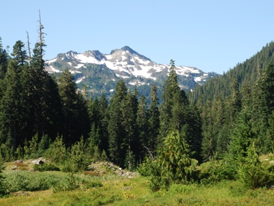
"Mount Zindorf"
SourceElevation
 : 5,541' (LiDAR) map: 5,539'
WA Rank
 : 2019
WA Prominence Rank
 : 1945
County
 : Jefferson
Quad
 : Mount Christie
Coords
 : 47.68705°N, 123.62453°W Notice
 : 47.68705°N, 123.62453°W Notice
Rise
 : 607' (LiDAR) map: 599'
Saddle
 : 4,934' (LiDAR) map: 4,940'
LiDAR Notes
Line Parent
 : 5569
Parent Lineage
Proximate Parent
 : 5569
Isolation
 : 1.57 miles
Daniel J. Evans Wilderness
Olympic National Park
YDS Class
 : 2 Discussion Disclaimer
Weather Link
Snow Depth
CalTopo
Trip Reports:
Submit a Trip Report
Links: peakbagger.com
Ascents:

0 members have reported ascents...
Click on map to view full-screen map
Images:

Click on  icons for info/definitions
 icons for info/definitions


