Big Bald
NC, TN 
BGN Page DatasheetElevation
: 5,516' (LiDAR) map: 5,516'NC Rank
: 55NC Prominence Rank
: 8TN Rank
: 12TN Prominence Rank
: 3Counties
: Unicoi & YanceyQuad
: Bald CreekCoords
: 35.98977°N, 82.49019°W Notice
: 35.98977°N, 82.49019°W NoticeRise
: 2,571' (LiDAR) map: 2,576'Saddle
: 2,945' (LiDAR) map: 2,940'LiDAR Notes
Line Parent
: Big ButtParent Lineage
Proximate Parent
: Big ButtIsolation
: 16.19 milesUnicoi County Highpoint
Cherokee National Forest
Pisgah National Forest
YDS Class
: 1 Discussion DisclaimerWeather Link
Snow Depth
CalTopo
Custom List Entries
Trip Reports:
Submit a Trip Report
Report 1
Report 2
Report 3
Report 4
Links: peakbagger.com
Ascents:
64 members have reported ascents...
log in to view ascents
Click on map to view full-screen map
Images:
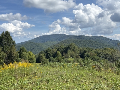 kirkmallory 09-09-2026 |  kirkmallory 06-01-2021 |  Rich P 05-11-2024 |  Tom Layton 07-06-2012 |
 wayfarer 01-30-2011 | |||
| Submit another image for this peak | |||
Click on icons for info/definitions
icons for info/definitions