Castle Peak
TX
Elevation: 3,290'
Rise: 60'
County: Randall
Quad: Fortress Cliff
Line Parent: Luciano Mesa
Proximate Parent: Mesa Redonda
Isolation: 113.37 miles
YDS Class: 4 Suggest Revision
Add ascent
Weather Forecast
Snow Depth
Images:
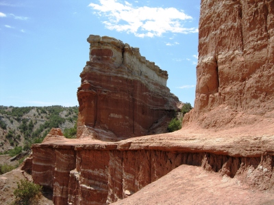 susanjoypaul 08-09-2011 | 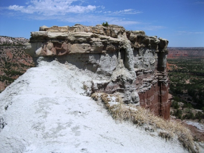 susanjoypaul 08-09-2011 |
Submit another Image
Trip Reports:
Submit a Trip Report
Ascents:
1 member has reported an ascent...
log in to view ascents