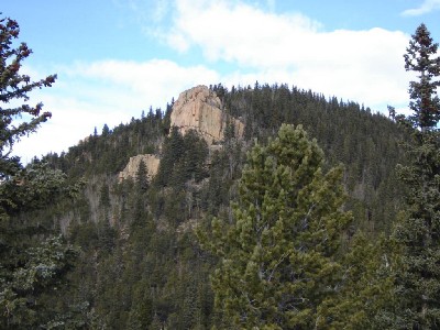
Arthur, Mount
CO
Elevation: 10,805' (LiDAR)
Rise: 242'
County: El Paso
Quad: Manitou Springs
Line Parent: Garfield, Mount
Proximate Parent: Garfield, Mount
Isolation: 0.34 miles
YDS Class: 2 Suggest Revision
Add ascent
Weather Forecast
Snow Depth
Images:
 cftbq 11-19-2007 |  KevinBaker | 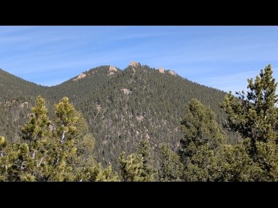 Kiefer Thomas 03-28-2026 |
Submit another Image
Trip Reports:
Submit a Trip Report
2022-08-23 - Andrew Wahr
2012-03-04 - lukePlumley
2010-05-14 - Steve Knapp
2007-11-18 - cftbq
Links: peakbagger.com
Ascents:
63 members have reported ascents...
log in to view ascents