Sunflower, Mount
KS
KS State Highpoint
Elevation: 4,041' (LiDAR)
Rise: 28'
County: Wallace
Quad: Mount Sunflower
Line Parent: 7189
Proximate Parent: Two Buttes
Wallace County Highpoint
Isolation: 98.15 miles
YDS Class: 1 Suggest Revision
Add ascent
Weather Forecast
Snow Depth
Images:
 John Kirk 10-26-2009 |  Landers 10-07-2022 | 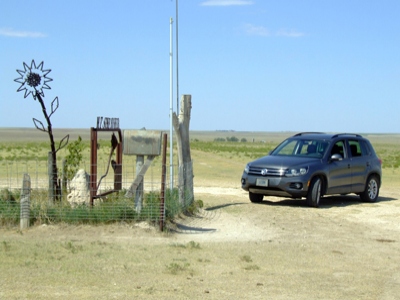 mapman 01-01-2013 |
Submit another Image
Trip Reports:
Submit a Trip Report
2017-08-24 - Nuernberger Josef
2010-08-21 - drdickie
Links: peakbagger.com
Ascents:
317 members have reported ascents...
log in to view ascents