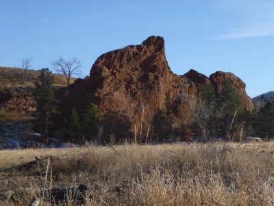
"Bock Fin"
CO
Elevation: 6,306' (LiDAR)
Rise: 65'
County: El Paso
Quad: Manitou Springs
Line Parent: 8123
Proximate Parent: 8123
Isolation: 2.05 miles
YDS Class: 5.7 Suggest Revision
Add ascent
Weather Forecast
Snow Depth
Images:
 KentonB 11-27-2013 |  StewartMGreen 08-16-2016 |
Submit another Image
Trip Reports:
Submit a Trip Report
Ascents:
1 member has reported an ascent...
log in to view ascents